
Trade & Travel

The spread of Islam opened up new trade routes westwards across North Africa into southern Spain, and eastwards from Persia into India. Extensive travel led to the widespread availability of navigational instruments such as the compass, and more accurate maps were compiled. These were also important for military and administrative purposes.
For faithful Muslims it was vital to be able to calculate the five daily prayer times and the direction of prayer towards Mecca. A common instrument was the qibla indicator, an adaptation of the compass designed to indicate the direction of Mecca from other major cities. These often incorporated similar features to the sundial.
Related objects:
 | Compass |
 | Inclining Dial |
 | Qibla Indicator |
 | Qibla Indicator & Horizontal Pin-Gnomon Dial |
Page last modified: 05 February 2013
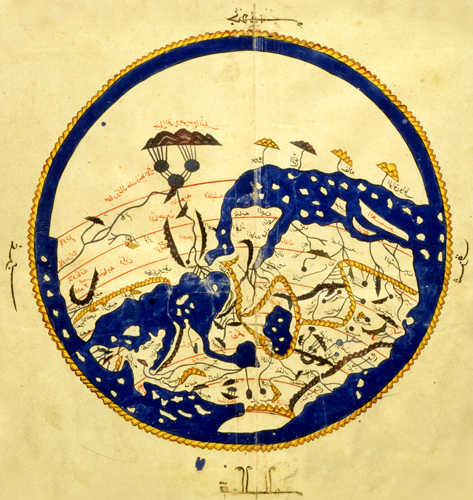
Map of the world created by traveller and writer,
al-Idrisi in 1154 for Roger II, King of Sicily
(oriented with South at the top)
Bodleian Library, University of Oxford